

Local Projects
Maven Mapping Solutions brings extensive local experience delivering land surveying and geospatial services throughout Washington State. Our team has supported municipal, transportation, and infrastructure projects across the Puget Sound region, providing accurate data, reliable project coordination, and advanced remote sensing solutions. With a strong understanding of local regulations, permitting requirements, and project standards, we help public agencies, engineers, and developers successfully plan and execute complex projects.


Lower Duwamish Waterway - Phase 3
Maven Mapping Solutions assisted True North Land Surveying and Anchor QEA by collecting aerial LiDAR and photogrammetry data of various locations along the Duwamish River. Our main focus was collecting detailed information on, around and beneath multiple docks and piers. These locations are deemed hazardous and the only way to collect the data was via UAS/UAV. By using our drone systems, we were able to successfully collect dense point clouds that were used to create final existing conditions maps for future ecology clean-up plans.
Client: True North Land Surveying / Anchor QEA
Location: Seattle, WA
City of Fife - 58th Ave & Valley Ave E Roundabout Design
Maven Mapping Solutions completed a full design topographic mapping and boundary effort in support of a new roundabout design at the intersection of 58th Ave E and Valley Ave E in the City of Fife. A combination of terrestrial LiDAR, aerial photogrammetry and traditional survey methods were used to produce the final map. A full boundary survey was completed to support the creation of easements along the project.
Client: Ardurra (Perteet) / City of Fife
Location: Fife, WA


City of Aberdeen - Division & State St Stormwater Replacement
Maven Mapping Solutions assisted the City of Aberdeen by completing a large topographic mapping effort for the city to design their stormwater replacement. Aerial LiDAR, aerial photogrammetry, 3D laser scanning, GNSS/GPS and traditional survey methods were combined to create a detailed map of the roadway corridor and stormwater facilities.
Client: HDR / City of Aberdeen
Location: Aberdeen, WA
City of Renton - Renton Municipal Airport Topographic Survey
Maven Mapping Solutions provided supplemental topographic data to support the ongoing facility upgrades at the Renton Municipal Airport. Using traditional survey collection methods, our team completed topographic mapping along the airport's taxiway to aid in pavement analysis for future upgrades.
Client: Century West Engineering / City of Renton
Location: Renton, WA


City of Bonney Lake - Surveying On-Call
Maven Mapping Solutions was selected for the Surveying Services On-Call for the City of Bonney Lake. This 5-year contract allows Maven to support our local community by supplying high-quality surveying services to the various projects being completed by the City. We are proud to be trusted by our local government!
Client: City of Bonney Lake
Location: Bonney Lake, WA
Cedar Grove Compost Survey
Maven Mapping Solutions assisted the Cedar Grove Composting facility in Maple Valley by completing a topographic survey of part of their facility for the purpose of designing a new building. Aerial LiDAR and photogrammetry were collected, along with traditional survey control and mapping of a local retaining pond.
Client: Cedar Grove Composting
Location: Maple Valley, WA


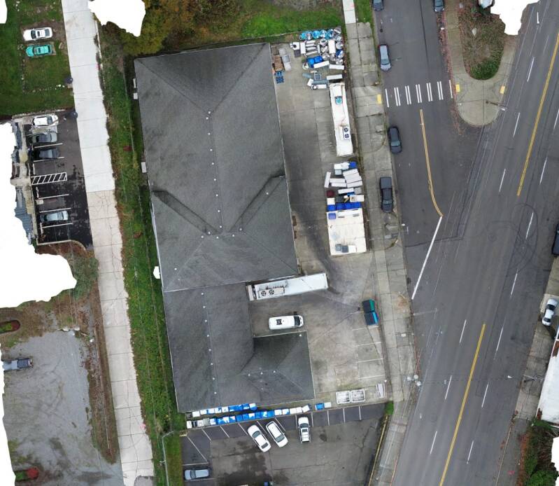
Fawcett Avenue ALTA / NSPS Land Title Survey
Maven Mapping Solutions assisted a local industry partner by providing topographic mapping information and aerial imagery for the completion of an ALTA / NSPS Land Title Survey for a commercial property transaction.
Client: True Point Services
Location: Tacoma, WA
Cell Tower Survey
Maven Mapping Solutions completed a topographic survey of a recently installed cellular tower. Traditional survey methods were combined with aerial photogrammetry to create a base map. The photogrammetry data collected was then turned into a point cloud in order to extract additional information required for the tower as-built map.
Client: True Point Services
Location: Gig Harbor, WA


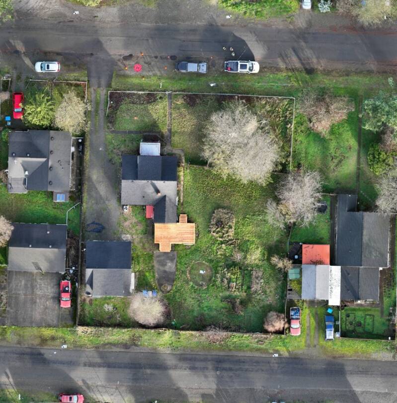
Polk Street Lot Survey
Maven Mapping Solutions employed multiple technologies to efficiently map a large lot in preparation for subdividing. GNSS and other traditional survey methods were used to establish the boundary, which aided in planning for subdividing the subject property.
Client: Private Owner
Location: Tacoma, WA
Hear from our satisfied partners
Our commitment to excellence shines through in every project. Don't just take our word for it—discover what our clients say about partnering with Maven Mapping Solutions for their capital improvement needs.